
Map Selection
About Map Selection
The Map Selection node asks the end user to select a location on a map.
It is a UI node and can be used when the workflow needs the user to provide a location, address, point, or area.
How Map Selection works
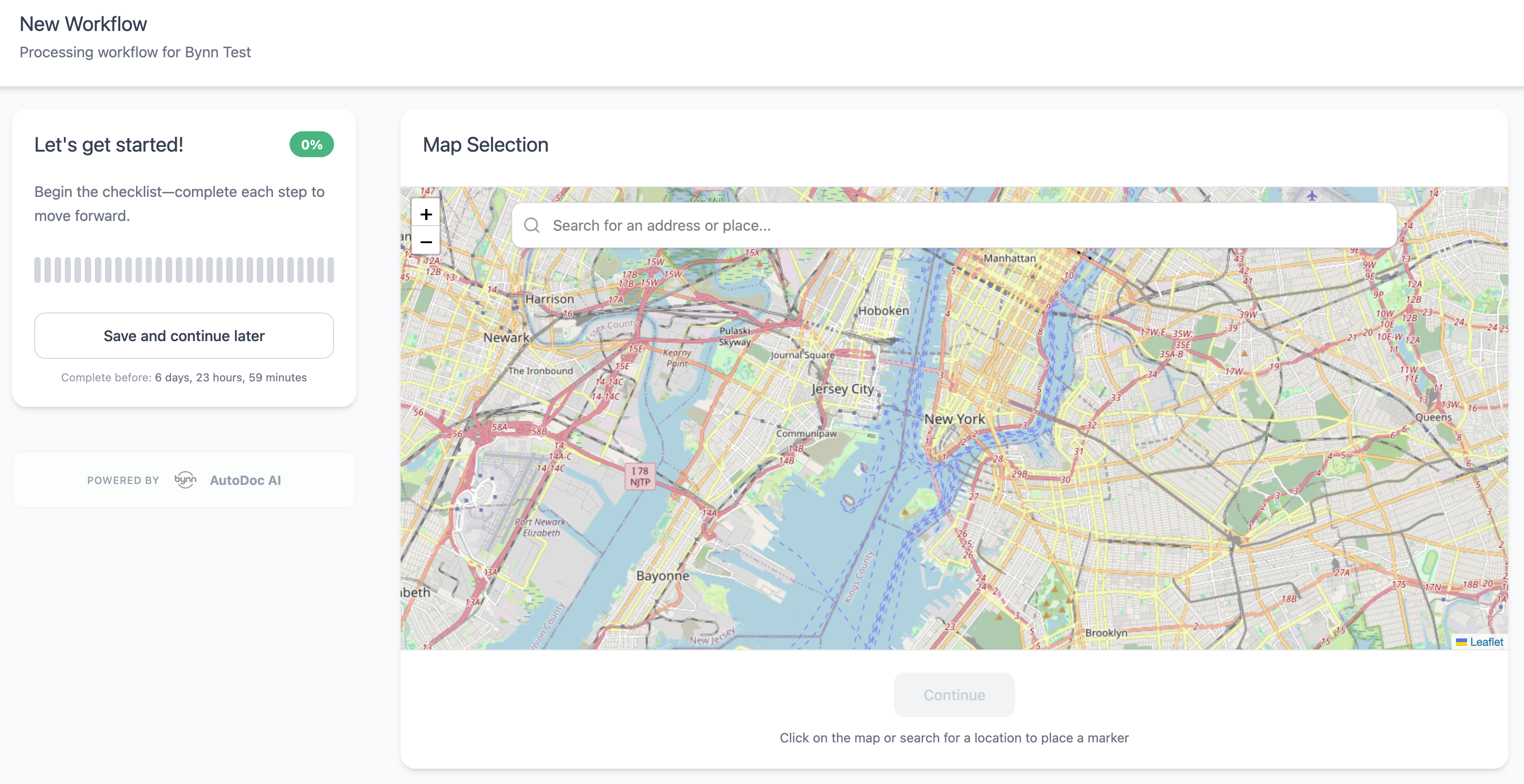
When the workflow reaches this node, the end user is shown an interactive map.
Depending on the selected mode, the user can either choose a specific point or address, or draw an area on the map. After the selection is made, the user continues to the next step in the workflow.
Settings
The node currently includes the following settings:
- Node Name
- Description
- Map Title
- Map Subtitle
- Help Text
- Map Type
- Location Access
- Selection Mode
Map Type
The available map types are:
- Street Map
- Satellite Hybrid (with streets & labels)
Location Access
If you enable "Ask user for current location" but the user denies permission, the map will display centered on a default location (usually the user's country or a global default) rather than their current position. Users can still manually search for an address or click on the map to select a location.
Selection Mode
The available selection modes are:
- Ask for a point/address
- Ask for an area
In point/address mode, the user can search for an address or click directly on the map to place a pin.
In area mode, the user places points on the map to define an area.
Saved Location Data
The selected location is saved and available for use in later workflow steps.
For point/address selection, the saved data includes:
location_lat– Latitude coordinatelocation_lng– Longitude coordinatelocation_address– Street address (if identified)location_type– Type of location selected (e.g., "point", "address")location_coordinates– Combined lat/lng object
For area selection, the saved data includes:
location_polygon– Array of lat/lng points defining the area boundarylocation_area– Calculated area size (if available)
These values can be referenced in later nodes using the variable syntax {location_lat}, {location_lng}, etc.
Example Uses
The Map Selection node can be used when a workflow needs location input from the end user.
Examples:
-
Insurance claims
Ask the user to mark where damage, loss, theft, or an incident occurred. -
Property and real estate workflows
Ask the user to select a property location, site boundary, or relevant land area. -
Delivery, logistics, or field service workflows
Ask the user to confirm a pickup point, delivery location, service address, or operating area. -
Loan, leasing, or asset verification workflows
Ask the user to identify the location of an asset, property, vehicle, or business premises. -
Permit, licensing, or local compliance workflows
Ask the user to define the location or area connected to an application, license, or request.
Updated 4 months ago